💡TL;DR
POPCORN is a lightweight population mapping method using free satellite images and minimal data, surpassing existing accuracy and providing interpretable maps for mapping populations in data-scarce regions.
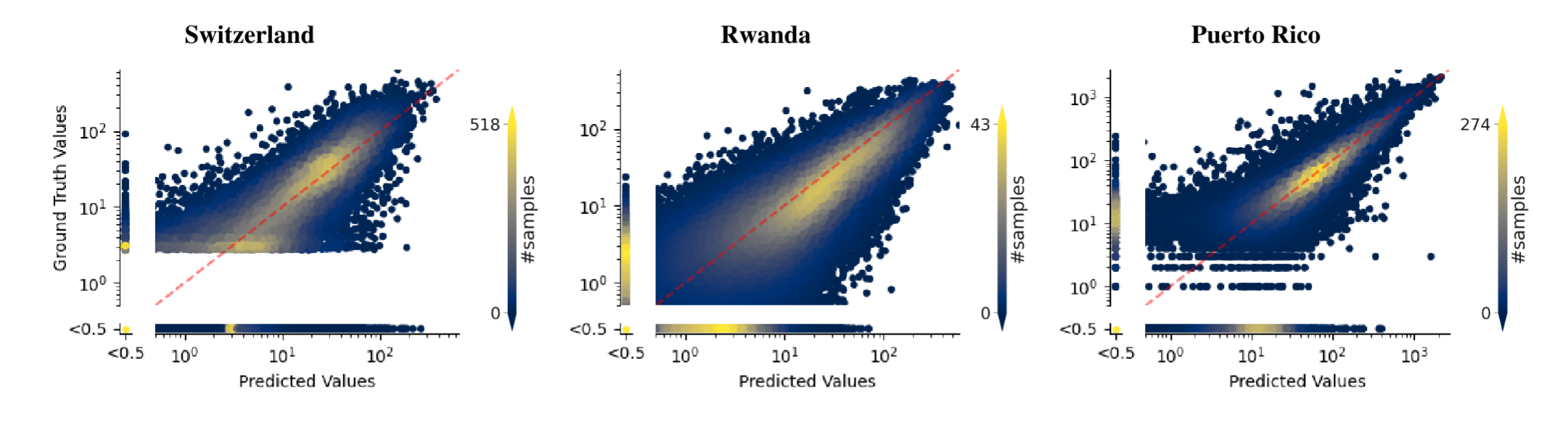
We evaluate the performance of POPCORN on three datasets: Switzerland, Rwanda, and Puerto Rico.
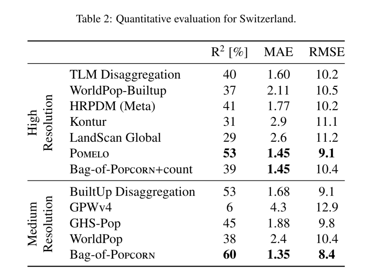
Our ensembled version BAG-OF-POPCORN outperforms existing methods including those with access to high-resolution satellite imagery and building footprints. Update [Jan 2026]: Check out Bourbon 🥃, which achieves higher accuracy than the original ensemble while relying exclusively on Sentinel-2!
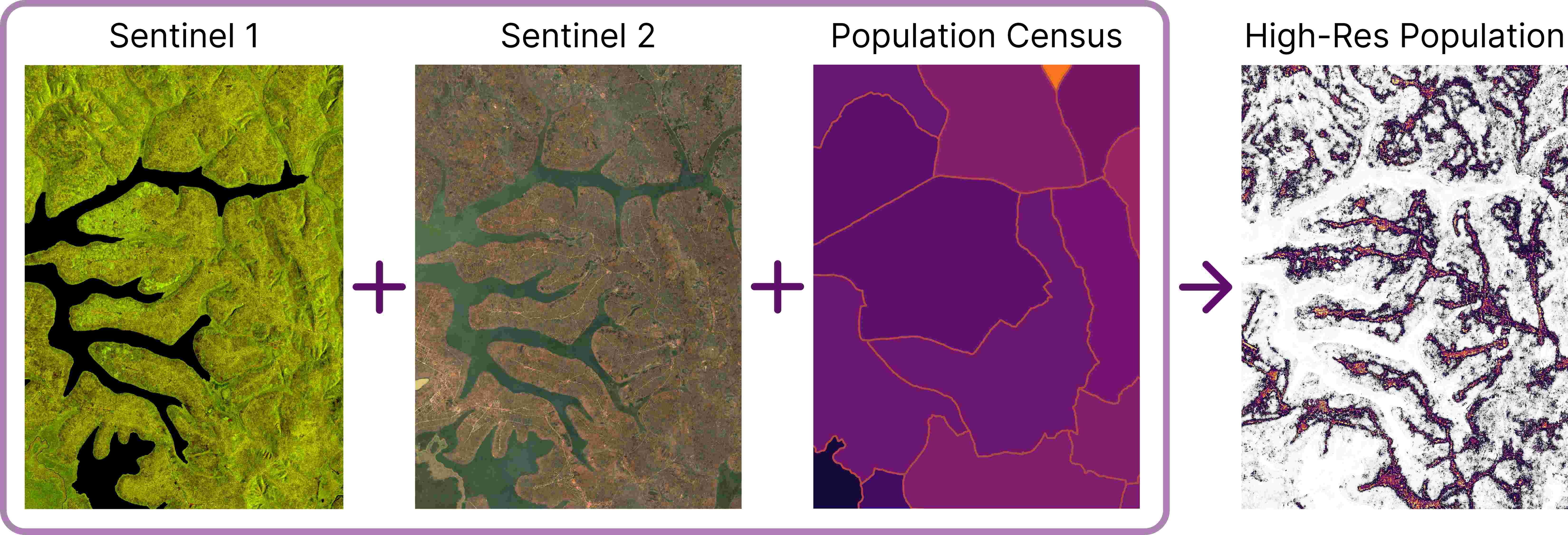
The core of our method is a neural network model, termed POPCORN. It uses Sentinel-1, Sentinel-2 and a coarse population census outputs high-resolution population maps.
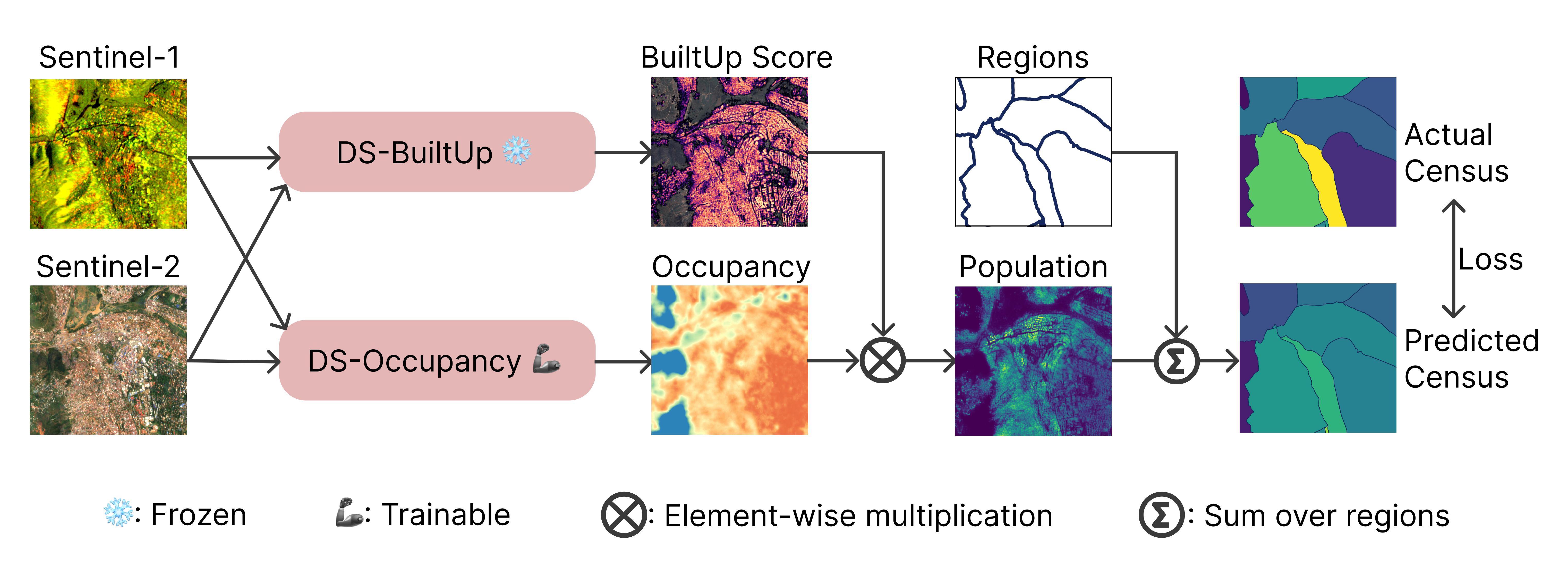
The model has two components: (1) a pre-trained, frozen built-up area extractor; and (2) a building occupancy module that we train through weak supervision with coarse census counts, as illustrated in the Figure below. The model operates at the full Sentinel-1/-2 resolution, i.e., its output has a nominal spatial resolution of 10m. However, for the final product and evaluation, we recommend aggregating the raw output to a 1ha (100x100m) grid, as done for the evaluation of the paper.
@article{metzger2023high,
  title={High-resolution Population Maps Derived from Sentinel-1 and Sentinel-2},
  author={Metzger, Nando and Daudt, Rodrigo Caye and Tuia, Devis and Schindler, Konrad},
  journal={arXiv preprint arXiv:2311.14006},
  year={2023}
}